Soverel Lakes
The Lakes throughout Soverel Field and
Watsessing Park (once called Watsessing Plain) have changed over
the years as various parts of the Second River were dammed up,
and then broken up.
The map below was made in 1881, nine years after
the 1872 map we have been following. In that time, the formation
of the lakes has changed considerably. The red star centers on
the house of Matthias Soverel.
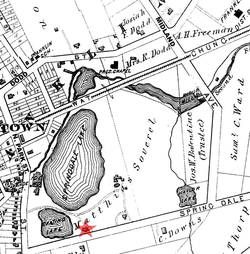
The street names have been augmented to make
them complete and clear.
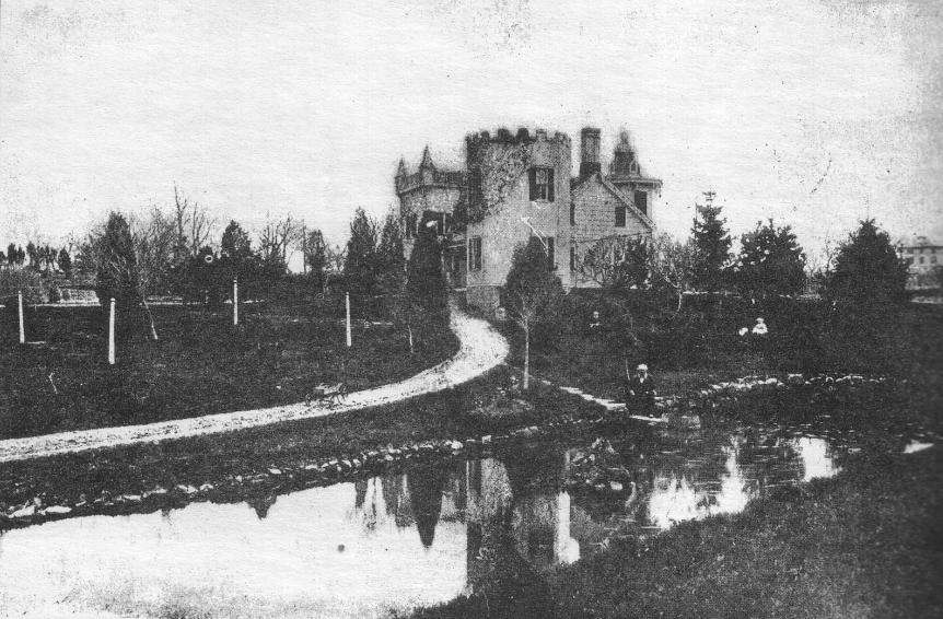
The Soverel House overlooking the Skating Lake
as it is named on the map. The first Soverel House was built in
1757.
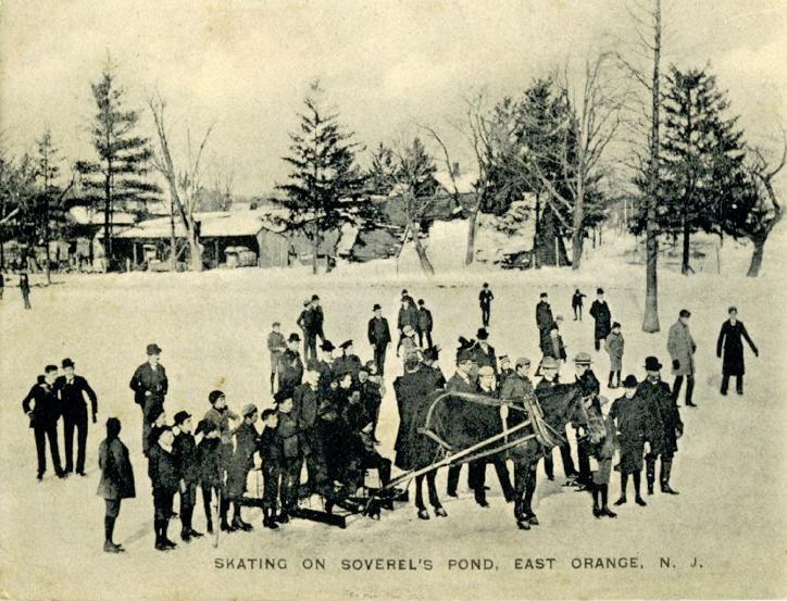
The smaller body of water was more properly a pond than a lake
because it was so shallow. In the winter, this pond was used for
ice skating.
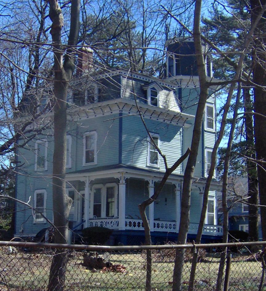
The Soverel House has been changed many times
over the years. Alterations were made in 1840, 1864 and 1870, but
it still stands beside Soverel Field on Springdale Avenue in East
Orange today (as of 2014).
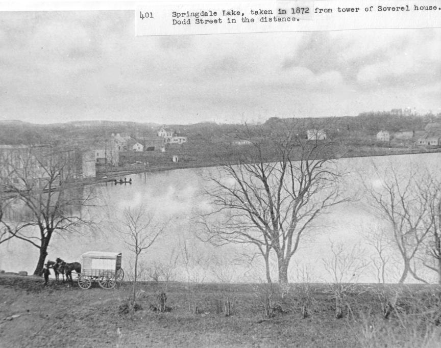
The more commercial (money-making) lake was
called Springdale Lake. Through the trees on the left, we can
just make out the old ice house where ice blocks were chopped
from the lake in winter and then buried in sawdust to insulate
them so they would last during the summer. Ice would have been
sold in large blocks from carriages like the one in the
foreground. There were no refrigerators- only ice
boxes. A block of ice might last a week or more in an ice box
to keep your food cold and fresh.
Further Resources of Interest on this
subject: